Soil EM Surveys
Unlock the Secrets of Your Soil
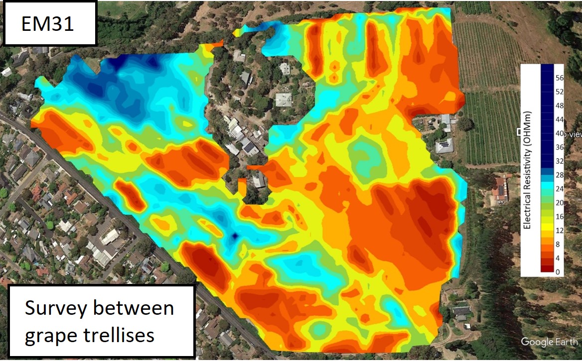
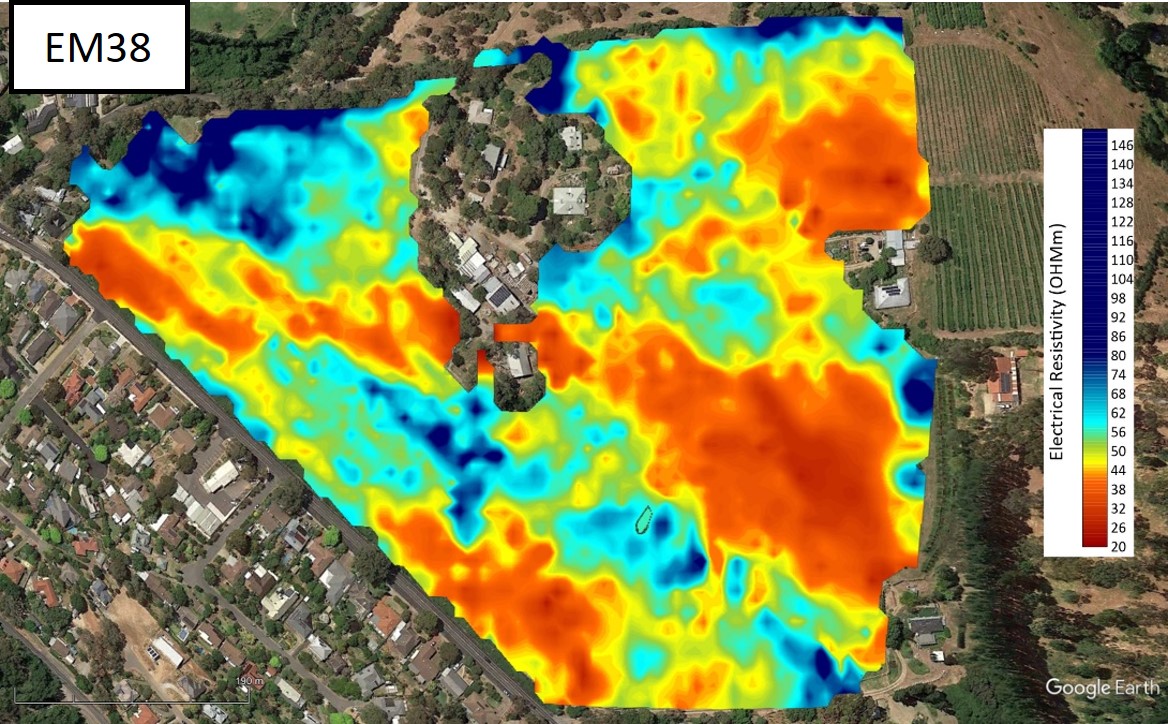
Discover Precision Soil Insights with EM31 & EM38 Surveys
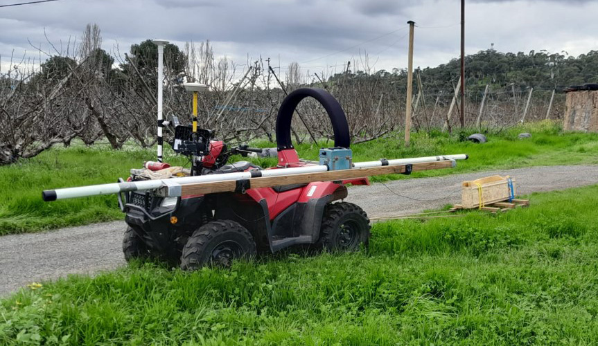
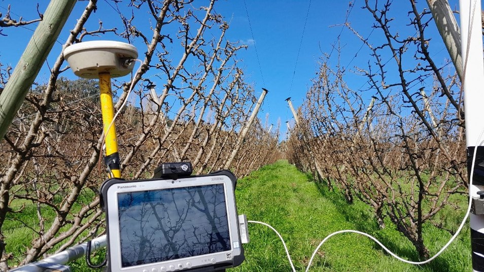
EM31 & EM38 are non-invasive soil mapping tools that use the electromagnetic induction (EM) principle to detect spatial variation of ground salinity, moisture and texture.
| Specifications | EM31 | EM38 |
|---|---|---|
| Focal Depth (50%) | 1.5 - 3m | 0.3 - 0.8m |
| Depth of Investigation | 6m | 1.5m (vertical dipole) |
| TX-RX Separation | 3.66m | 1m |
| Survey Vehicle | Quadbike Sidemount (1m above ground) | Quadbike Sled (0.1m above ground) |
Measure rootzone salinity with precision, ensuring optimal growth and yield. With accurate data, you can implement effective irrigation strategies, prevent water stress, and enhance crop quality
Key Insights
- Map your soil’s salinity, moisture, and texture
- Make informed decisions for higher crop productivity
- Map for variable rate irrigation and fertilization
- Target land management
- Plan Drainage
- Quick surveys
Maximize your insights with combined surveys
By harnessing the capabilities of both sensors, EM31 and EM38 data can be integrated to produce enhanced images and to accentuate features that would otherwise not be easily detected. Maps of difference between repeated EM38 surveys correlate with change in soil water content.
Deliverables
- Cleaning of data - removal of obvious metal interference.
- High-resolution images and visuals for in-depth data analysis.
- Technical reports in PDF format.
- Google Earth KMZ for easy navigation to points of interest.
Looking for more
- The Geonics EM31 and EM38 are established, reliable instruments useful for cost effective mapping but in some cases other technology application will be appropriate:
- Multidepth instruments offer extra capabilities: AgTEM Wallaby images to tens of metres deep, geo-electric streamers or prong-frames image up to 8 layers and are great used under water for seepage remediation, and we can source EM38-4 or DualEM instruments when requested.
- Soil moisture probes or drilled cores can be integrated with mapping to classify entire paddocks.
- Mapping instruments fitted to farm machinery can conduct mapping each time the instrument is moved, transmitting to the internet while the operator focuses on farming.
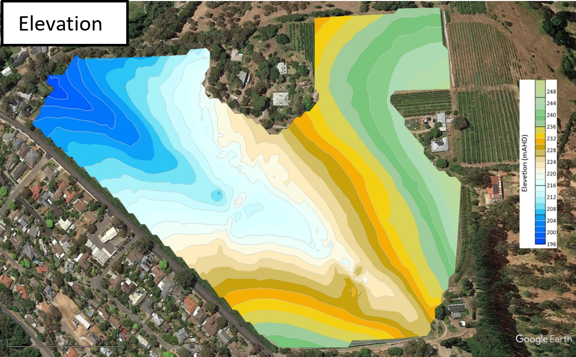
Sample Datasets
EM31 and EM38 Survey Pricing
All costs quoted ex GST
| Basic (EM31 OR EM38) | Combined (EM31 & EM38 | ||
|---|---|---|---|
| Mobilization & Demobilization | A$ 1.95 per km | A$ 1.95 per km | |
| EITHER | Setup and packup | 1hr = $100* | 1.5hr = $150* |
| and Linear Kms | A$ 65 per km* | A$ 80 per km* | |
| or equivalent Area (10m line spacing) | A$ 65 per Ha* A$ 26 per Acre* |
A$ 80 per Ha* A$ 32 per Acre* |
|
| OR | Day rate (minimum 1 day) | A$ 3000* | A$ 3000* |
| Option - any non-standard Data Processing~ | A$ 120 per hour | A$ 120 per hour | |
| Option - Topography (decimetre accuracy – dual frequency post processed kinematic GNSS) | A$ 500 per survey day | A$ 500 per survey day | |
| + Overnight costs away from home | A$ 200 per night | A$ 200 per night | |
* So we are not caught out with troublesome sites or logistical requests, unless arranged prior, we charge the greater of the linear kilometre rate or the day rate for surveys (note the hectare rate is directly linked to the kilometre rate and just provided for convenience).
~ Standard processing includes coloured-worm-images as kmz files (nightly), if lines are closely spaced, gridded images as kmz files, CSV files and PDF report.
Download EM31 and EM38 Survey Pricing