For Geotechnical Engineers
We assist in Geotechnical Investigations
AgTEM Wallably and Wallaroo and Wombat all image different depth ranges and in different situations. For some sites simple EM31 or EM38 mapping will suffice at lower cost.
With our 4m stroke auger rig we can complete shallow investigative drilling, permeability measurements and piezometers down to 13m in the same mobilization as for geophysical mapping.
As we are geophysical specialists, for full geotechnical service we typically work with a local provider.
AgTEM cart reduces cost of large scale geotechnical site characterization
Soil and rock moisture content and salinity are generally related to rock competency and soil properties. These properties are strongly proportional to earth electrical resistivity which is mapped, in 3D by AgTEM cart.
AgTEM cart is ideal for supplying large scale detailed ground variability maps at multiple depths. To accurately convert these to geotechnical property maps additional information from drilling, trenching or other methods is used. This combination is much cheaper than grid drilling or sampling.
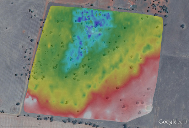
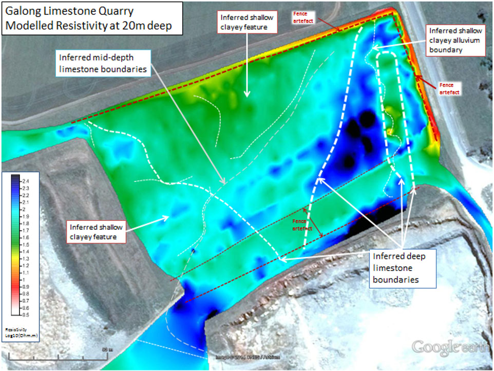
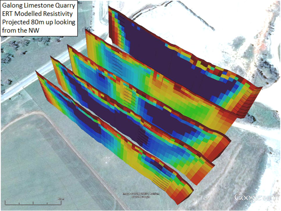
Rock hardness inferred from AgTEM mapping at 12m deep
Limestone quarry blast pattern optimization
AgTEM at 12m – 2 hours acquisition
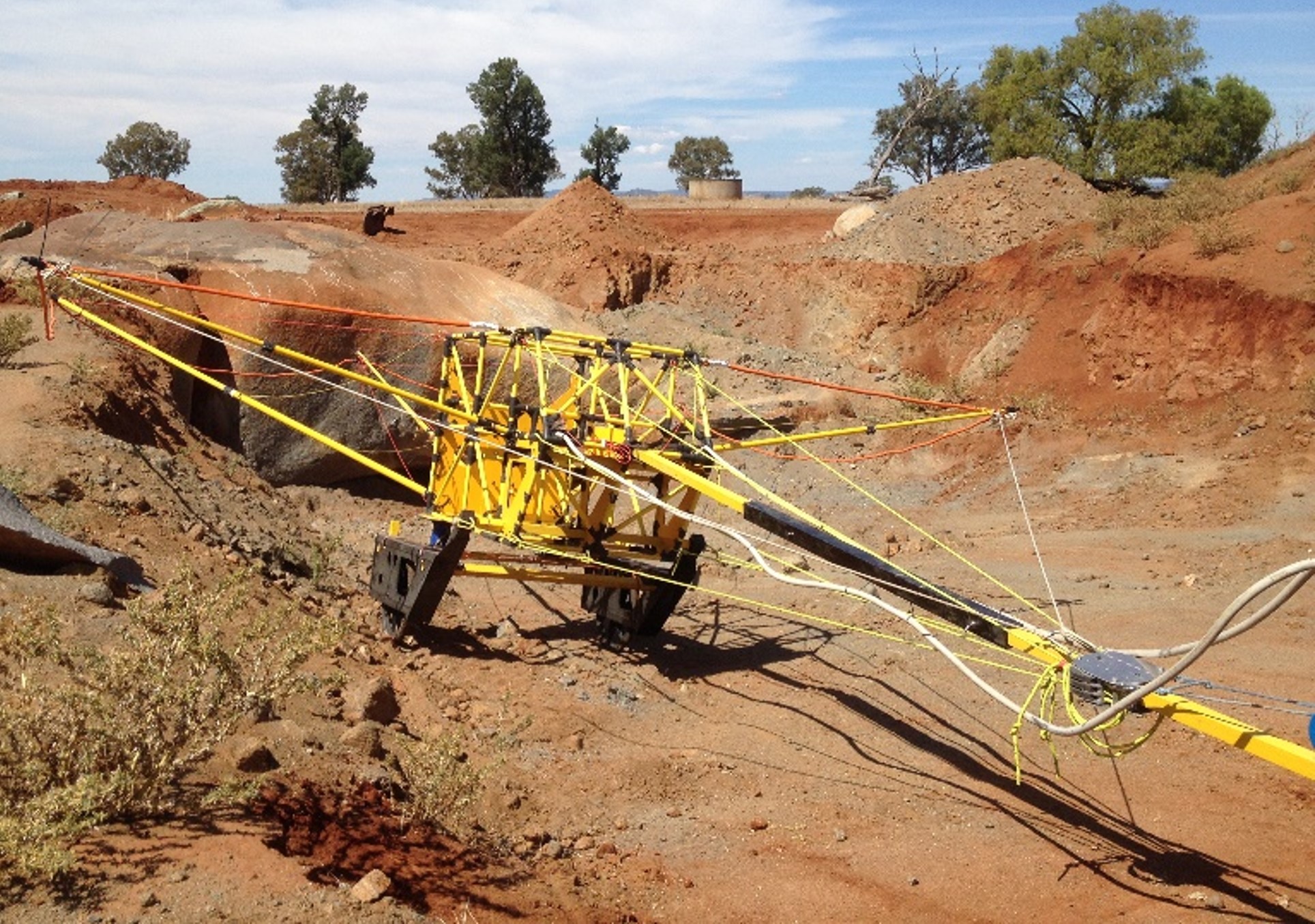
Resistivity survey using electrodes, 2 days
Three techniques were compared at one limestone quarry. AgTEM data provided the most detail at least cost. Ground penetrating radar could not effectively penetrate beyond 1m at this site. AgTEM arrives on site – is set up in less than 2 hours and surveys.
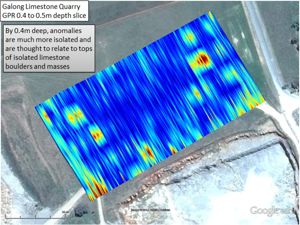
Ground Penetrating Radar – 250MHz
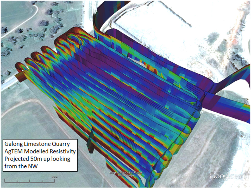
AgTEM 0 to 50m deep – 2 hours acquisition