HERBI irrigation channel cross and long section survey


- Price: Price on application
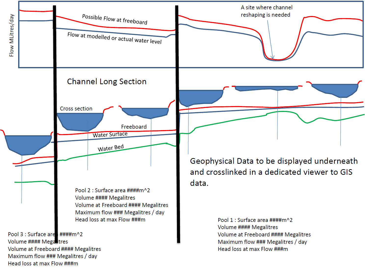
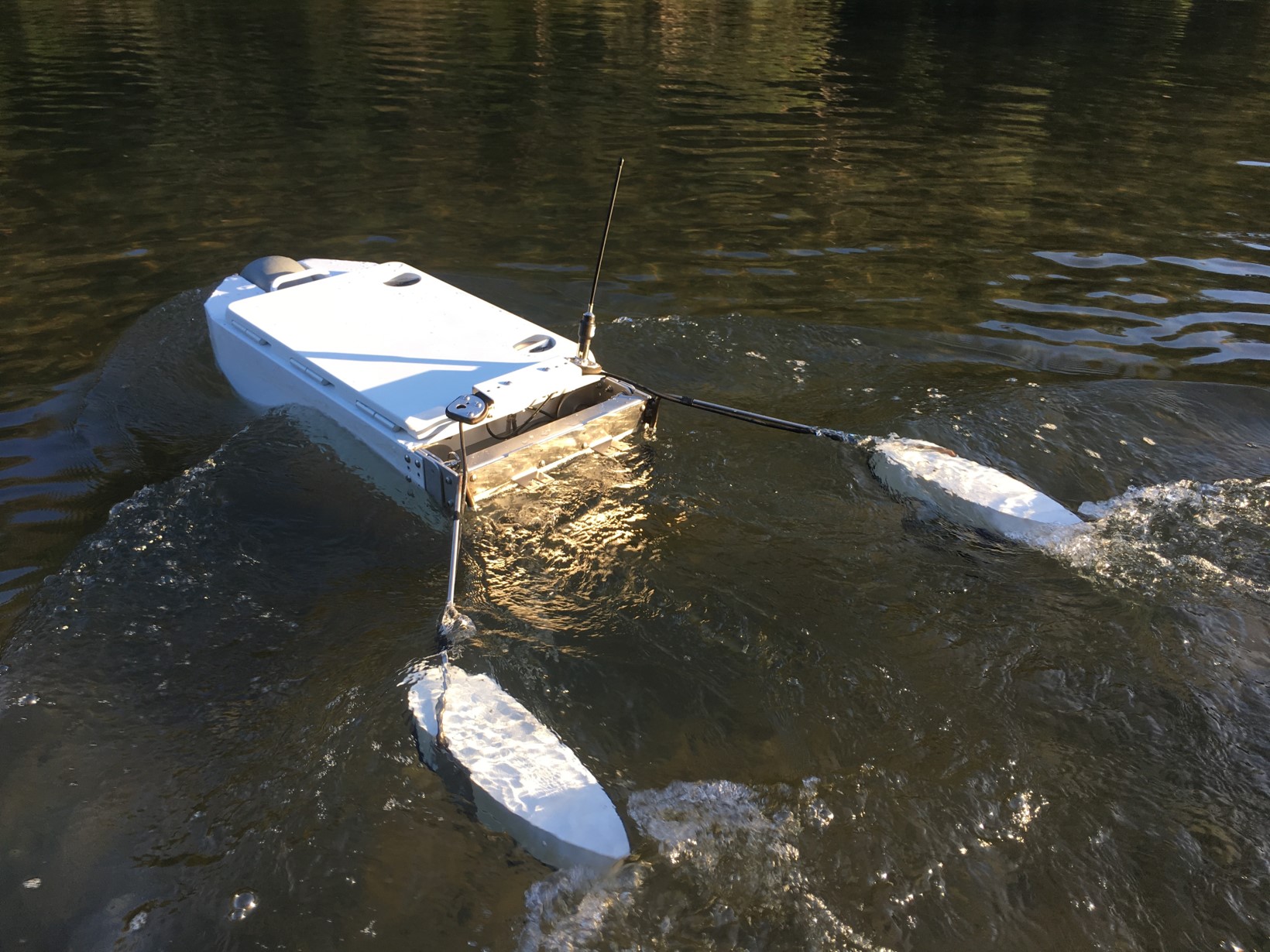
As of January 2025 lots of effort has been put into collecting full irrigation channel cross and long section data from HERBI-USV, particularly in autonomous propulsion mode. The technique involves zig-zagging along channels and using many sensors and comprehensive coordinate transformation and data cleaning to make representative cross sections along a long section of the deepest part of irrigation channels. Rather than the standard drone LIDAR approach of indiscriminate gridding of data with large angular errors in coordinate transformations, the HERBI approach involves intelligent bilinear gridding that iteratively creates cross sections in intervals along the channel using data obtained right in the channel such that angular and other errors are of little consequence. In effect we are trying to collect just the data needed rather than all point cloud data anywhere remotely in the vicinity of the channel. We also tie all coordinate transformations together by surveying from the water rather than both from a drone and from the water.
As of January 2025, we have some computer code, have tried and tested several LIDAR and other distance sensors and own and have tested scanning sonar equipment and dual frequency GNSS survey equipment with centimetre precision capability. When NSW Water (Now DCCEEW) advised they intended to collect all reservoir hydrographic data using airborne LIDAR our market got extinguished and this project has never recovered and DCCEEW got duped into accepting rubbish data. As a result of no support, it is with great disappointment I have to declare that this project is currently shelved.